|
<< BACK
|
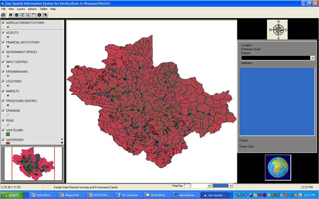
GEO-SPATIAL INFORMATION
SYSTEM FOR HORTICULTURE (HORTI-GIS) FOR WAYANAD DISTRICT
90 percent of the total cropped area in Kerala has been occupied by horticultural
crops. The sector has started attracting entrepreneurs for taking up horticulture
as a commercial venture. Comprehensive information is necessary for the proper management
of horticultural resources. Remote Sensing technique and GIS plays a significant
role in the improvement of the present system of acquiring and generating horticultural
data. The Project "Development of Horticulture Geo-Information System (Horti-GIS)
for Wayanad district" aims towards this direction
OBJECTIVES
1.Generation of Spatial map of marketing outlets and existing stalls.
2.Accessibility to the market from production site.
3.Generation of data base on Horticulture Data.
4.Identification of cultivable areas for unconventional, high value crops.
5.Suitability of waste land for Horticulture Development.
6.Development of integrated Information System in GIS platform.
|
PROJECT TEAM
P.K Mohanthy,I.A.S,Director (Chief Co-ordinator)
Dr.B.Ramesh Kumar(Project Investigator)
Sinu V.I(Project Fellow)
Hareesh R.S(Programmer)
Ratheesh G.S,Bindhu(Field Assistant)
|
|
|